
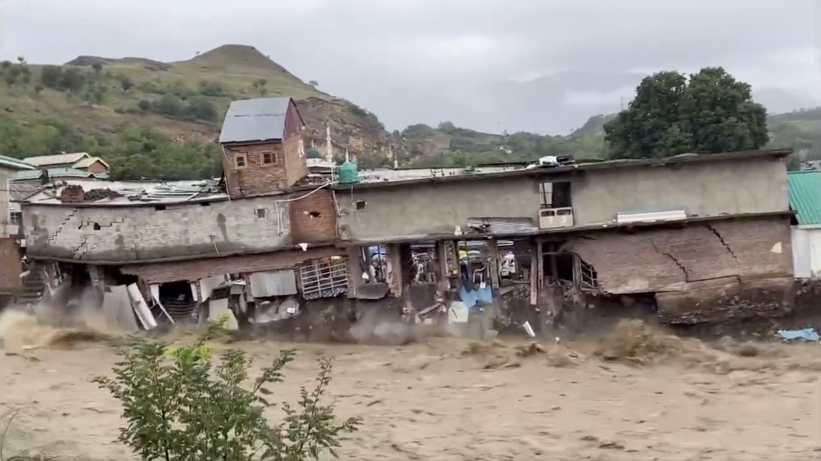
Every year, the monsoon’s arrival in Assam brings a familiar mix of anticipation and anxiety. But between July 18 and July 24, 2026, that anticipation turned to devastation. In under 48 hours, a massive surge of monsoon rain sent rivers roaring over their banks, plunging Upper Assam into its worst deluge in over sixty years. From Sivasagar to Jorhat, the floodwaters swallowed entire histories, washing away ancestral homes, destroying vital crops, and leaving thousands of families stranded.
The Scale of the Disaster
- Timeline: Flooding intensified sharply on July 18–19, 2026
- Worst-hit districts: Charaideo, Jorhat, and Sivasagar
- Deaths: 80+
- People affected: Over 200,000
- Villages submerged: 856, across 12 districts
- People displaced: Around 700,000
- People in relief camps: Roughly 300,000
What sets this year apart is that the districts hit hardest weren’t the usual suspects on Assam’s annual flood-alert list. It’s a reminder that predicting the monsoon’s path is growing harder — the pattern of who gets hit is no longer following the old script.
Why Assam Floods Every Year
To understand why this keeps happening, let’s look at Assam’s geography. Consequently, the state is boxed in by mountains on three sides. It has two major rivers—the Brahmaputra and the Barak—running through it. There’s only one narrow natural outlet for water, through Bangladesh.
That means whenever heavy rain falls on the surrounding hills, almost all of it funnels straight into the Assam valley with nowhere to drain quickly. Because of this geography, roughly 40% of Assam is flood-prone by default — even in a normal monsoon year.
Why Was 2026 So Severe?
This year’s flooding traces back to unusually intense rainfall upstream. On July 18–19, the Wokha, Mokokchung, and Mon districts of Nagaland, along with Charaideo in Assam, received far more rain than normal — Nagaland recorded 137 mm in just 8–9 hours. Mokokchung saw above-normal rainfall, and Charaideo recorded rainfall 436% higher than usual.
The Assam government has pointed to this rainfall spike as the main trigger. Within hours, water levels in the state’s rivers — especially the Brahmaputra — crossed the danger mark, catching many communities off guard.
Let’s look at why the Brahmaputra River is so impactful
The Brahmaputra River is one of the biggest rivers, flowing from different regions: Southwestern China, Northeastern India, and Bangladesh. Depending on where you are, the river goes by different names — the Brahmaputra in Assam, the Yarlung Tsangpo in Tibetan, the Siang/Dihang in the Mishmi language, and the Jamuna once it enters Bangladesh. On its own, it ranks as the world’s 9th-largest river by discharge and the 15th-longest.
The Brahmaputra isn’t just a big river. It is one of the most sediment-heavy rivers in the world. As it travels from Tibet through Arunachal Pradesh into Assam, it cuts through unstable mountain terrain. Consequently, this terrain constantly erodes, feeding huge quantities of silt and debris into the water.
In fact, per square kilometer, the Brahmaputra carries far more sediment than even the Amazon.
Here’s the problem: once the river reaches the flat Assam plains, it slows down — and all that sediment starts settling instead of flowing onward. Over time, this raises the riverbed itself, like a bathtub slowly filling with sand. A higher riverbed means the river can hold less water before overflowing.
The numbers reflect this. Surveys from 1912–1928 showed the Brahmaputra spread across roughly 3,870 sq km. By 2006, that had grown to about 6,000 sq km — with the river’s width increasing by up to 15 km in some stretches.
The 1950 Earthquake That Still Matters Today
This slow buildup got a violent push on August 15, 1950, when an 8.7-magnitude earthquake struck Assam. Known as the strongest earthquake ever recorded on land in the 20th century, it was caused by continental collision. The earthquake killed approximately 1,526 people in Assam alone.
In a chain reaction, massive landslides sent entire mountainsides crashing into the Brahmaputra River, dumping so much sediment that the river’s flow was temporarily blocked. The backed-up water eventually forced a new path, but with an even higher riverbed. At Dibrugarh, the riverbed reportedly rose by up to 10 feet because of that single event, in what locals in Assam called “Boliya Pani“—the water flowing out of madness.
Since then, the Brahmaputra has kept shifting course year to year, meaning some historically flood-prone areas dry up while entirely new areas start flooding — redrawing the flood map roughly every decade.
Why New Areas Flooded This Time
Traditionally, the districts most associated with Assam’s floods are Dhemaji, Lakhimpur, Barpeta, and Morigaon — names that come up nearly every monsoon. But in 2026, the worst-hit districts were Charaideo, Jorhat, and Sivsagar — places with no real history of flooding this severe.
Assam’s Chief Minister, Himanta Biswa Sarma, acknowledged that officials and residents in these districts simply weren’t prepared, because there was no precedent for a flood of this scale in living memory — the last comparable event being the 1950 earthquake-driven flood.
Government Promises vs. Reality
Assam’s floods have been a recurring election talking point for a decade, but the promises haven’t matched the outcomes.
| Year | Promise | Result |
|---|---|---|
| 2016 | BJP promises a “flood-free Assam” in Assembly election campaign | Party wins, but floods continue |
| 2017 | Government reaffirms flood-control efforts | Major flood; 160 deaths |
| 2018–2020 | Continued assurances | Floods occur every year; 100–200 deaths annually |
| 2021 | Home Minister Amit Shah repeats “flood-free Assam” promise in election rallies | Floods continue |
| 2026 | BJP campaigns again on a flood-free manifesto ahead of April elections | Assam experiences its worst flood in 60 years |
Despite a decade of continuous BJP governance in the state (with five more years ahead), the core problem remains unresolved.
Other Factors Making Floods Worse
Beyond geography, several human-driven factors are compounding the crisis:
- Climate change: Rainfall that used to spread across months is now concentrated into a few days, with intensity increasing by 50–100 mm per day in some events — leading to sharper, more destructive floods.
- Deforestation: Barren land can’t slow down or absorb rainwater, so runoff reaches rivers faster and carries more loose soil with it.
- Mining: Continued mining activity has added even more sediment into the Brahmaputra system.
- No floodplain zoning law: The central government asked all states to adopt floodplain zoning legislation — rules governing safe distances for construction and farming near rivers — back in 1975. Assam still hasn’t passed this law.
What Experts Recommend
Professor Parimal Chandra Bhattacharjee of Guwahati University argues that trying to fully “control” the Brahmaputra is unrealistic given the region’s geography — and may even invite bigger disasters. Instead, his — and other experts’ — recommendation is to focus on living with floods rather than preventing them entirely. That includes:
- Building homes on raised platforms in high-risk zones
- Constructing elevated community shelters equipped with drinking water, sanitation, and healthcare facilities
- Strengthening early-warning and forecasting systems
- Running disaster-management training at the panchayat (village council) level
- Making relief distribution more transparent and effective — including addressing past incidents like a viral video showing government-distributed food packets discarded as waste in floodwater
Assam actually piloted a “living with floods” scheme in the 1990s, but it was discontinued following corruption allegations. Experts argue such a scheme needs to be revived — this time with proper transparency and accountability built in.
Lessons from Japan
Japan offers a useful comparison. Geographically, it’s one of the most disaster-prone countries on Earth — frequent earthquakes, tsunamis, and active volcanoes. Yet its death tolls and damage from these events are consistently far lower than in comparable disasters elsewhere.
The difference comes down to preparation: robust early-warning systems that alert people before an earthquake hits, mandatory disaster-management training at the community level, earthquake-resistant building codes for new construction, and widespread public education on what to do in an emergency. This approach is credited with limiting damage even during a powerful 7.6-magnitude earthquake and tsunami Japan faced two years ago.
The takeaway: natural disasters can’t always be prevented, but their human cost can be dramatically reduced with the right systems in place.
Frequently Asked Questions
Why does Assam flood every year? Assam sits in a natural basin surrounded by mountains on three sides, with the Brahmaputra and Barak rivers carrying huge volumes of water and sediment into the valley, with limited natural drainage. As a result, around 40% of the state is flood-prone.
Why is the Brahmaputra River so dangerous? It carries an exceptionally high sediment load — more per square kilometer than even the Amazon — which continually raises its riverbed, reducing the amount of water it can hold before overflowing.
Can floods in Assam be prevented? Experts largely agree that floods themselves cannot be fully prevented given the region’s geography. Still, the resulting damage and death toll can be significantly reduced through better preparedness, early warning, and land-use planning.
Which districts are most flood-prone? Historically, Dhemaji, Lakhimpur, Barpeta, and Morigaon see the most frequent flooding. However, in 2026, Charaideo, Jorhat, and Sivsagar — districts without a strong flood history — were the worst affected.
What should people do during a flood? Move to higher ground or elevated platforms immediately, avoid entering floodwater, keep emergency supplies and important documents ready in advance, and follow local disaster-management and early-warning alerts.
Content Credits:
- WikiPedia
- Dhruv Rathee Youtuber